During our trip to Ireland and while we were staying near Killarney National Park, we knew we wanted to do a family hike. County Kerry is gorgeous and we were smiled upon by the weather gods (unlike on this epic hike!). The sun was shining and the sky was blue. We could see for miles. Who wouldn’t want to explore that?
But, strangely, it was a bit hard to nail down a good, family-friendly hike in the region. Ireland’s largest mountain, Carrauntoohil, was on the horizon. By all accounts, scaling that mountain is challenging and can be dangerous. I believe all those stories. That meant mountaineering was out.
When Mr. Family Trip found somewhere on the Internet the loop we ended up doing, at the base of Carrauntoohil and to a magical lake, we stumbled on gold.
Here’s more about our hike in Lisleibane (a version of the Cronins Loop trail on AllTrails) and at the foot of Carrauntoohil in Ireland.
About Lisleibane and Carrauntoohil, Ireland's largest mountain:
Lisleibane is a small town in Ireland that is only 0.95 square miles. It is the 596 largest townland in County Kerry. We didn’t stay in the town for very long.
But it is nestled in the MacGillycuddy Reeks. This mountain range in Western Ireland is only 12 miles long but houses the highest peaks in Ireland. Apart from Carrauntoohil (which gets its own paragraph or two below), it contains eleven of the fourteen peaks in Ireland over 3,000 feet.
All that land is privately owned! Not by one person, but by various land and property owners. A fractured ownership and a fractured vision for the mountain range. As late as 2019, there were news articles on a group banding together to make hiking accessible in the mountain range. It took considerable effort and organization to maintain the path we were on – and the Devils Ladder, which many mountaineers take to summit the peak, had been subject to erosion. Some are advocating for the creation of a national park here but I can’t find that there’s been any real traction.
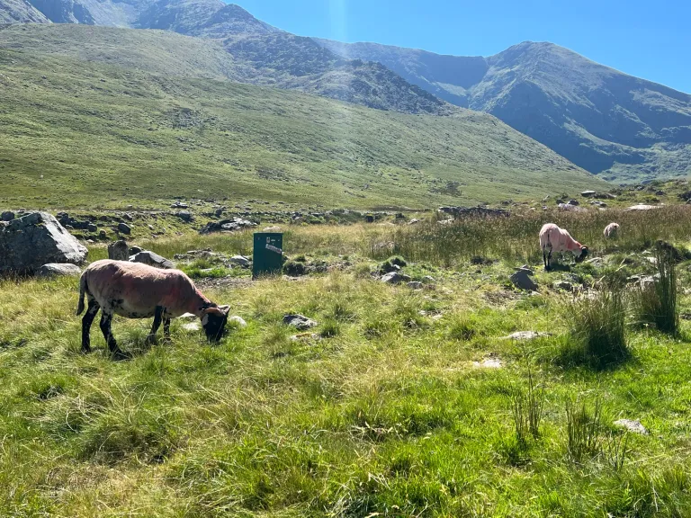
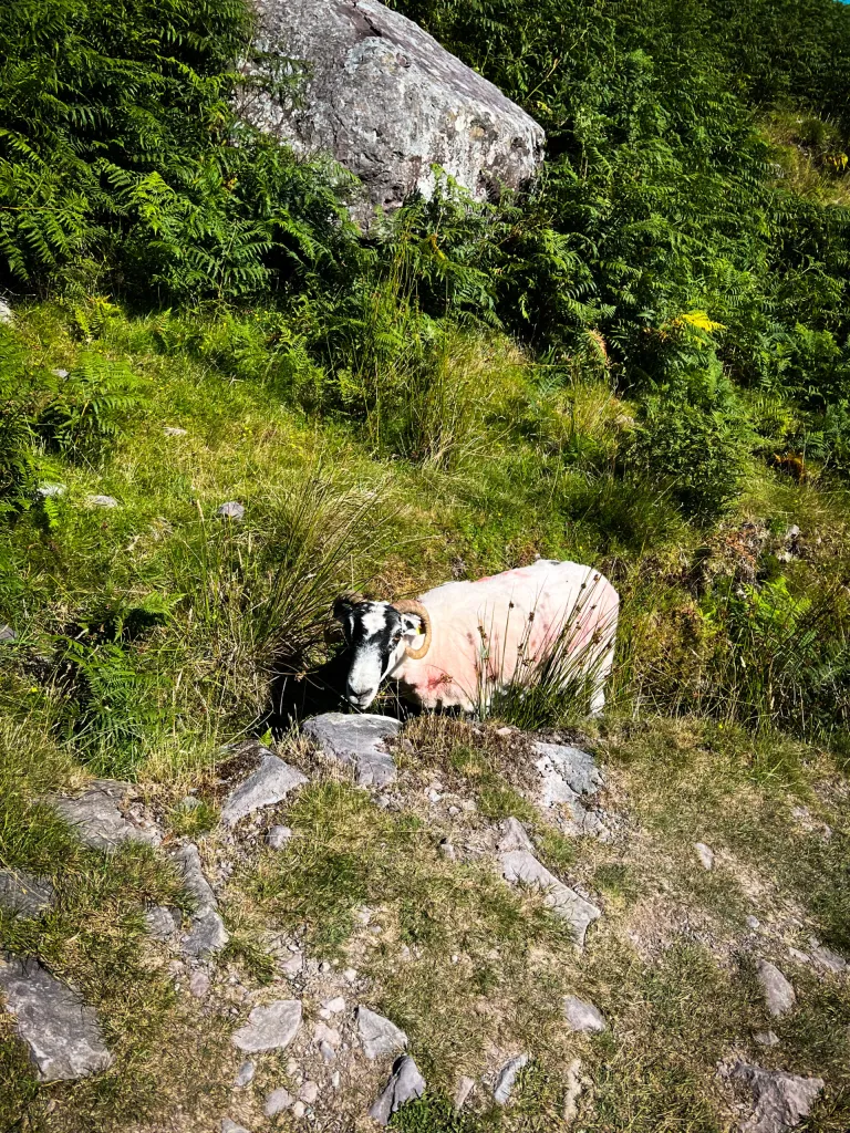
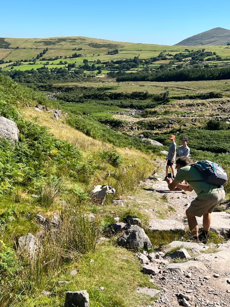
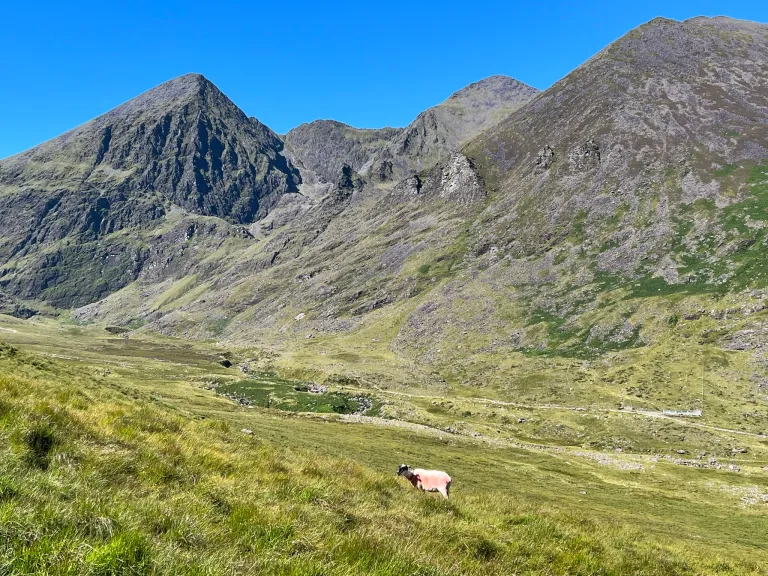
I suppose that explains why it was challenging for us to find information on a hike here. And also explains why there were sheep everywhere. of
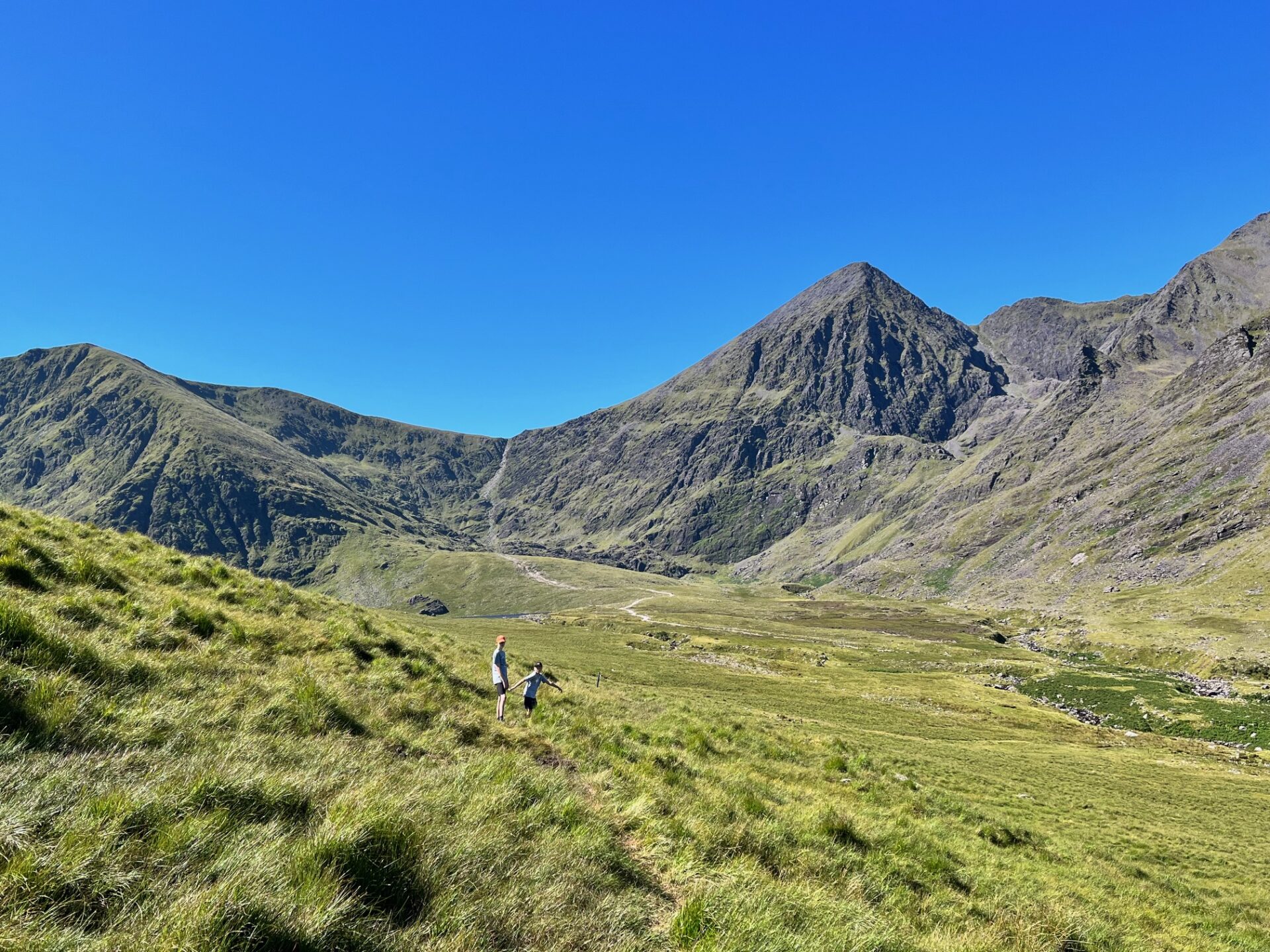
Carrauntoohil itself reaches up to 3,407 feet. It is Ireland’s highest peak.
Of course, not all elevation is created equal. It depends on where you start and how quickly you gain that elevation. Carrauntoohil springs out of the landscape – intimidating and impressive.
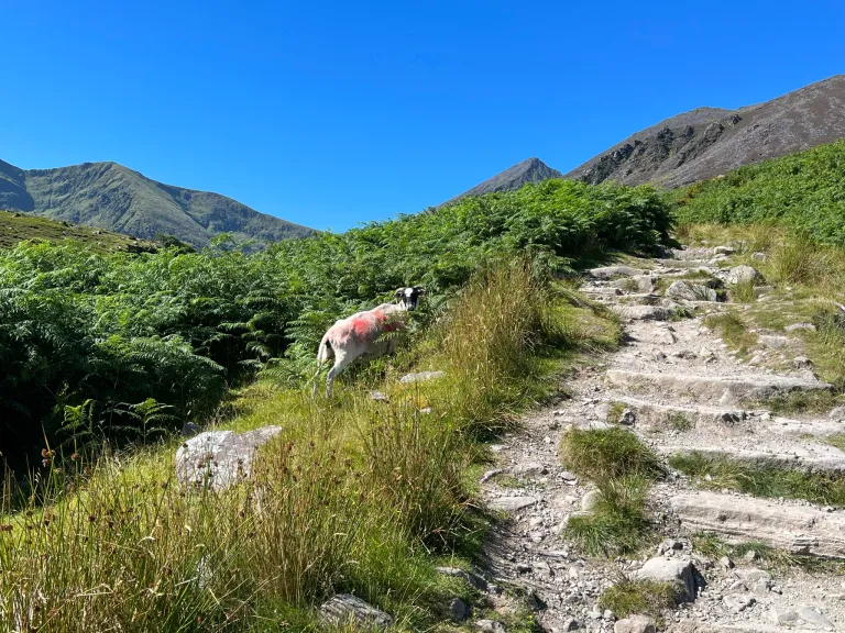
Carrauntoohil is made of Old Red Sandstone, creating purple and reddish colors where the verdant green grasses and the sheep don’t cover it. Glacial activity eons ago created brutal rock formations and luscious valleys.
Because the land is privately owned, no one really knows how many people summit the mountain every year. At the summit sits a cross (which has previously been cut down by people protesting the Catholic church and resurrected in various forms).
The peak is no joke. The Kerry Mountain Rescue team has signs posted everywhere. The terrain and the steepness make it challenging. As of 2017, the Kerry Mountain Rescue team estimated over 40 fatalities on this climb. We were quite fine keeping our own, and our kids’, feet on the lower ground, especially after our experience in the Grand Canyon.
hiking Lisleibane (a version of Cronins Loop) in Ireland:
The hike by the numbers:
4.19 miles 719 feet of elevation This took us just under two hours to hike. Skill level: moderate.
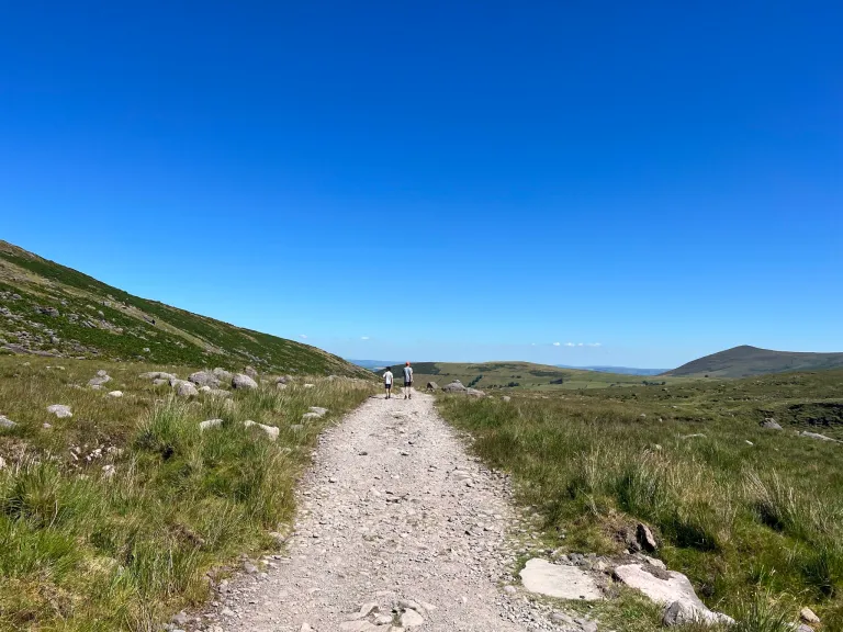
The terrain wasn’t difficult and the elevation changes were gentle.
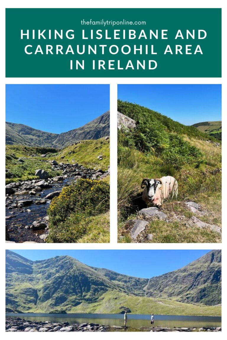
It is a lollipop shape – a pipestem that leads to a loop. The loop walks alongside the river and through an area called Hags Glen (I’ve alternatively seen it called The Hag’s Glen, which I like a lot better.)
Cronins Loop is a trail listed in AllTrails that is the same route we did (that we’re calling the Lisleibane Loop) but also shows how it can be accessed from the camping spot called “Cronins Yard.” This is a popular campsite for those looking to hike Carrauntoohil in full. Another resource says that the trail from Cronins Yard to this loop we did is called Cronin’s Yard Loop.
We easily found parking at the Lisleibane- Carrauntoohil trailhead carpark. Google Maps took us straight there, without any problems. Unlike our experience trying to find parking at the trailhead in the Burren, this was easy! At the time of our visit, a cart was there selling coffee as well as cold ice cream (which was much appreciated post-hike).
Once we followed the pipestem from the parking lot to where the trail divided in two, we chose to go clockwise around the loop.
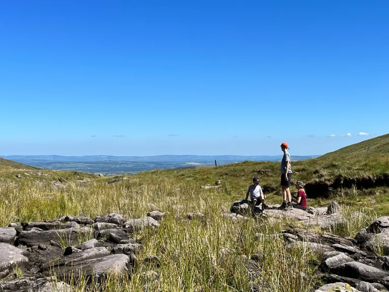
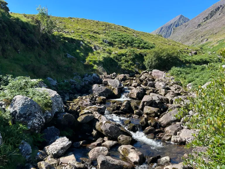
This meant we were going through the valley, the lowest section, and by the stream first. We started to slowly climb out of the valley and found ourselves on expansive fields and sweeping hillsides.
Once we began climbing out of the valley, the hike was marked by cairns (stacked rocks) along the horizon. It wasn’t too hard to follow the trail given the footsteps that had beat down the grasses before us. But it was fun to look out on the horizon and try to spy the next cairn. That reminded us of one of our favorite hikes we did out West.
In some areas, the ground was quite swampy, a bog. We were glad we had good hiking boots. We also were able to pick our way around the lowest areas by stepping on tufts or taking high ground.
It was, however, quite fun to get so close to the sheep. Mr. Family Trip, it turns out, is very good at “speaking sheep” and even had an intrigued wooly companion for awhile.
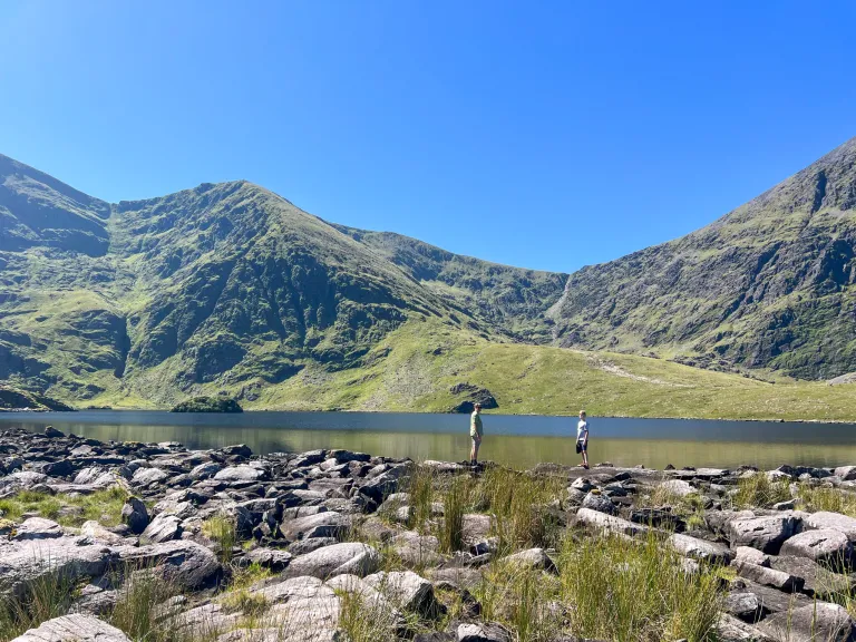
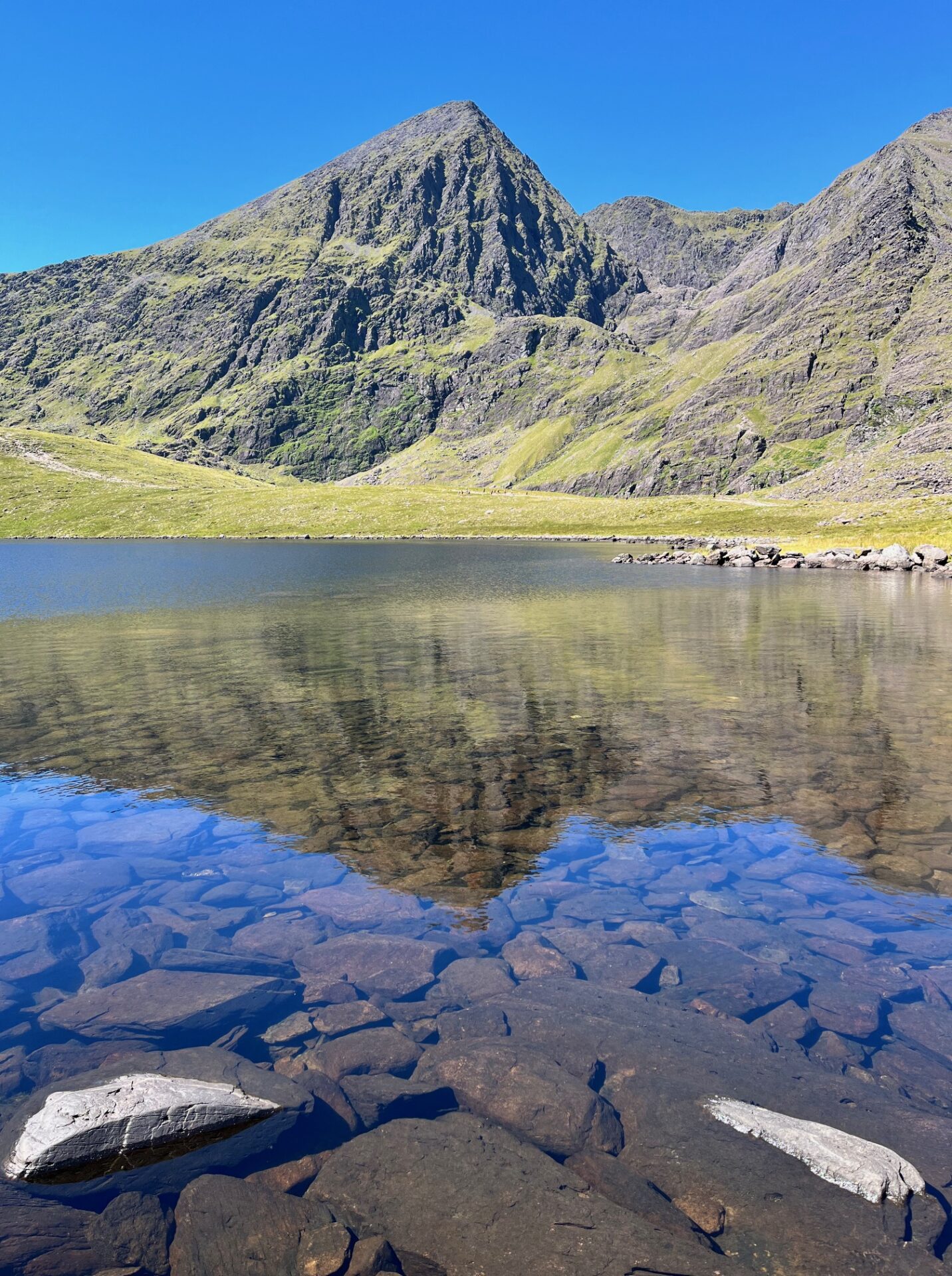
The apex of our hike was the rest at Lough Calleee.
From there, we could see the gnarly Devils Ladder geographical formation that those climbing the peak head up. (I did not feel motivated by it.) The Lough, or Lake, was crystal clear. While when we first arrived at the lake there was a tour group also resting. They soon left and we had the entire place, the entire valley, view, MacGillycuddy Reek, to ourselves.
The view is magnificent: the greenery is omnipresent, and the valley is little visited by tourists (as it is still little known). It’s like being alone in the world, in the heart of Ireland’s breathtaking open spaces!
Once again, I was reminded that when we travel, when we explore, there is so much of a country to see. A place is informed by its landscape. A people informed by the way the actual earth manifests itself. We are shaped by our centuries-long relationship with the ground that sustained us. It felt right to get out and see it, to experience it. This hike was worth it.
My hope for you, friends, is that it stays well-maintained and also secretive enough that you, too, will experience the glory of having the Irish countryside and the entire valley all to yourself.
More links on hiking Lisleibane (Cronins Loop) in Ireland: